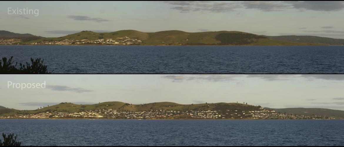
This project required the modelling of new sub-division on a large area of significant visual impact. Creating photomontages for the development application process was essential to the success of the application. While it was only a relatively small area to be developed initially, the client wanted to produce photomontages that captured the full extent of future development planned for the land in question.
The process included required roads, houses, gardens, fences, bush land scrub and open grasses all to be modelled. In excess of 400 houses were modelled, along with thousands of trees and shrubs and kilometres of road.
During development of the photomontages, many intervening steps became influential on the project as a whole. Many panoramic photographs were produced of the existing landscape, they became useful tools for the townplanners and developers to use. Subsequent additions were made to indicate the location of benchmark lines, areas of bush and the exact location of significant boundaries.